The Places the Green Crescent Trail Will Connect
Ten years ago, I was frustrated that I couldn’t safely push my daughter in a stroller from my house to a nearby park.
Maybe you’ve had your own version of this story.
The goal of the Green Crescent Trail is to change that.
We want to make it safer and easier to walk or bike to all the local places we already go.
Schools. Parks. Libraries. Campuses. Downtowns. Restaurants. Neighborhoods.
When those places are connected safely, walking and biking can become natural parts of our daily lives.
Here are a few of the specific places we hope to see connected.
Three Towns, Three Campuses
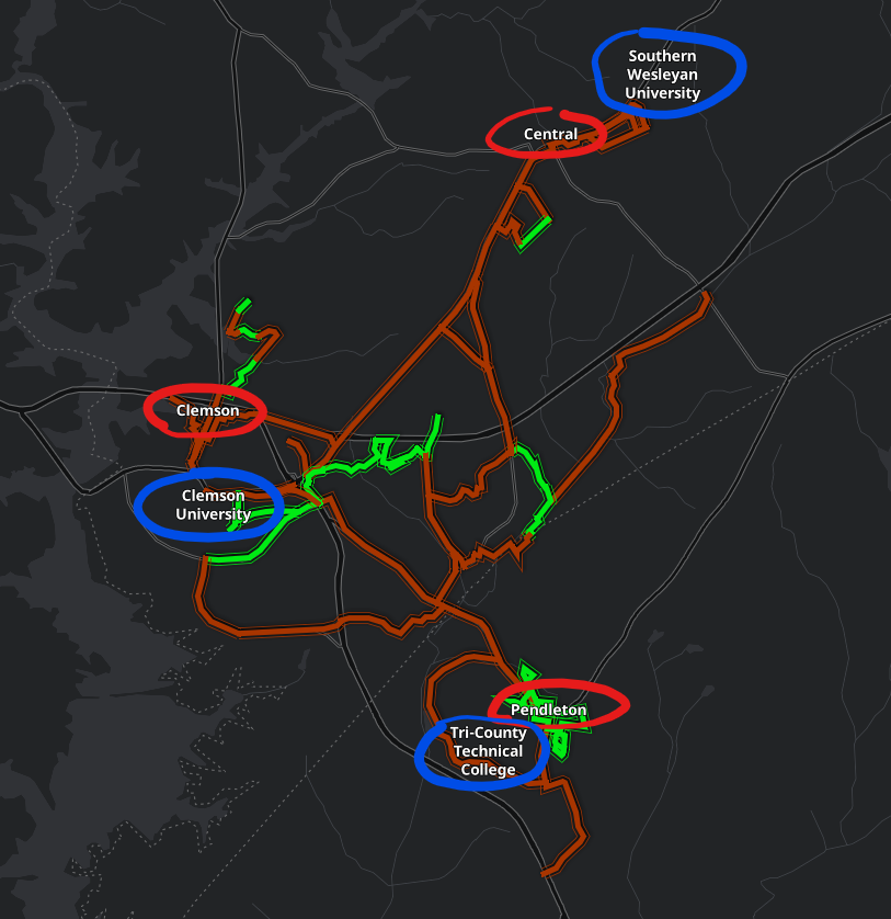
Three towns (red) and three campuses (blue), all connected by the future Green Crescent Trail network.
Three towns (red) and three campuses (blue), all connected by the future Green Crescent Trail network.
The Green Crescent Trail is designed to link three towns and three campuses that sit remarkably close together.
- Clemson
- Central
- Pendleton
And:
- Clemson University
- Southern Wesleyan University
- Tri-County Technical College
Few communities our size have this kind of proximity. The opportunity is not to build something entirely new, but to better connect what already exists.
Learning, Parks, and Everyday Destinations
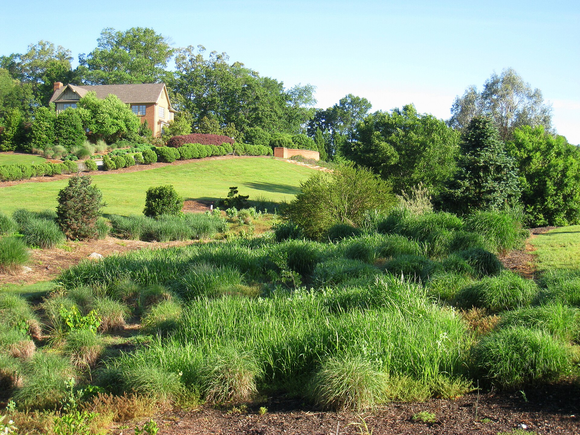
South Carolina Botanical Garden
The 15×30 campaign includes connections to major campuses, along with cultural and educational destinations like the South Carolina Botanical Garden, the Central-Clemson Library, and the Pendleton Library.
Parks are another key part of the network.
In Clemson, this includes Clemson Park, Nettles Park, Abernathy Park, and others that could serve as trailheads.
In Central, places like Bolick Field, the SWU bike trails, the disc golf course, and the Central-Clemson Recreation Center.
In Pendleton, the nature trails themselves form a system of park-like spaces around the town.
As these places become easier to reach without driving, they become part of everyday routines instead of occasional trips.
Downtowns and Local Gathering Places
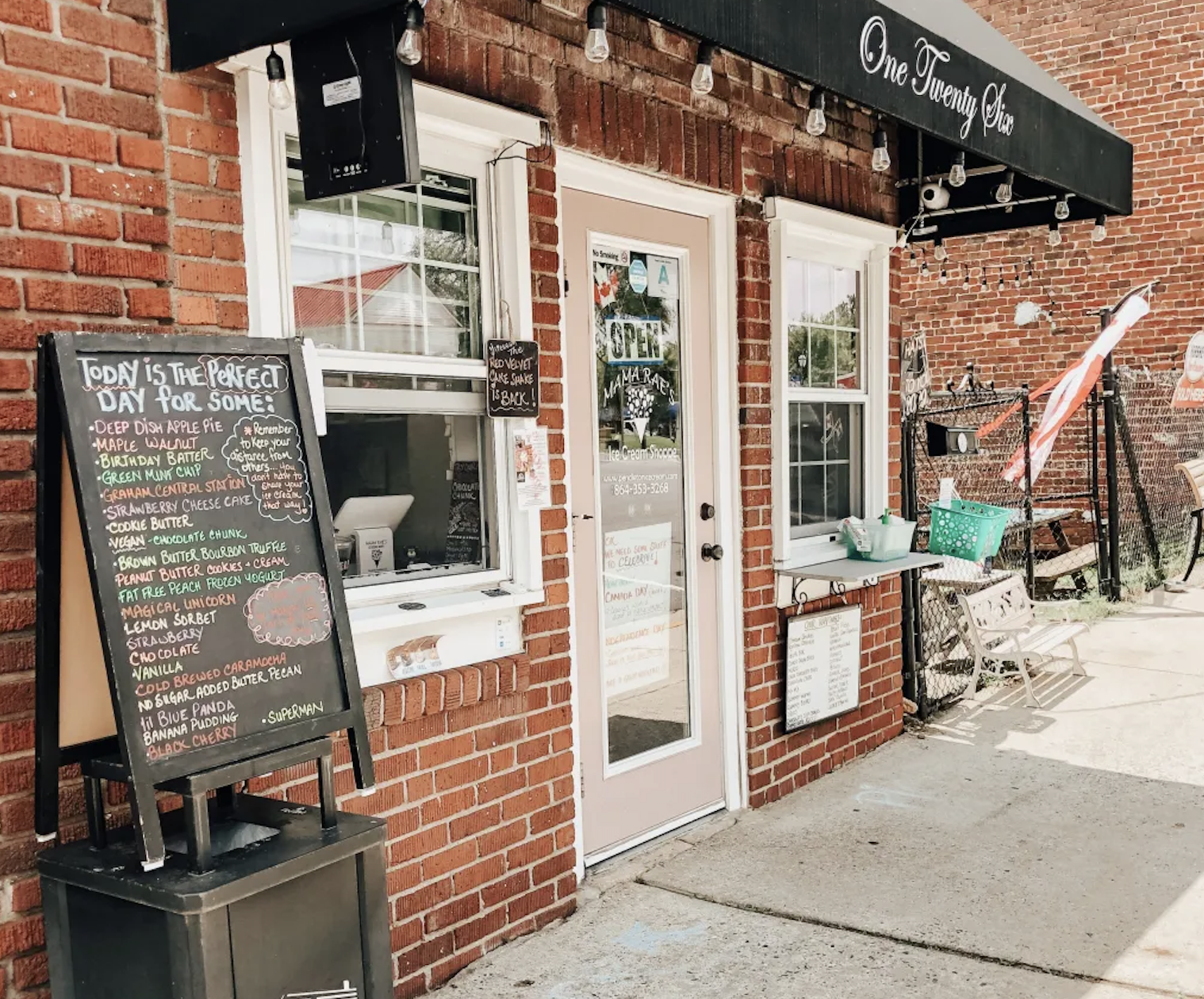
Mama Rae’s Ice Cream Shop on the Village Green in Pendleton
The Green Crescent Trail is also intended to connect the historic downtowns of Clemson, Central, and Pendleton.
These are the cultural and economic centers of each town. Safe walking and biking routes can make them easier to reach and more enjoyable places to spend time.
Sometimes the impact is simple.
In Pendleton, it might mean stopping at Mama Rae’s Ice Cream after a walk along the heritage trails.
In Clemson, it could mean walking from Abernathy Park to downtown or biking from Nettles Park to Sunnyside Café in Patrick Square.
In Central, it might mean a short walk between Depot Dog, the Roller Mills area, and Southern Wesleyan University.
You can see the potential for this kind of connection in nearby Travelers Rest, where the Swamp Rabbit Trail has helped reshape the downtown.
Where Every Trip Begins
All of these destinations have one thing in common. They only matter if people can reach them easily.
And most trips start in the neighborhoods where we live.
For the Green Crescent Trail to work, it needs to connect those neighborhoods to parks, campuses, libraries, restaurants, and downtowns.
That is why it is being developed as a network, not a single trail.
Looking Ahead
Today, parts of this system already exist, but many are not yet clearly connected or easy to follow.
Some links are already possible but not obvious. The connection between Nettles Park and Patrick Square is one example. With better signage and wayfinding, it could become a clear and usable route.
The goal of the 15×30 campaign is to strengthen and clarify these connections over time.
Because in the end, the Green Crescent Trail is not just about building paths.
It’s about making it easier to move between the places we already love in Clemson, Central, and Pendleton.

